 Above: Watch WESH 2’s continuous live coverage of Milton
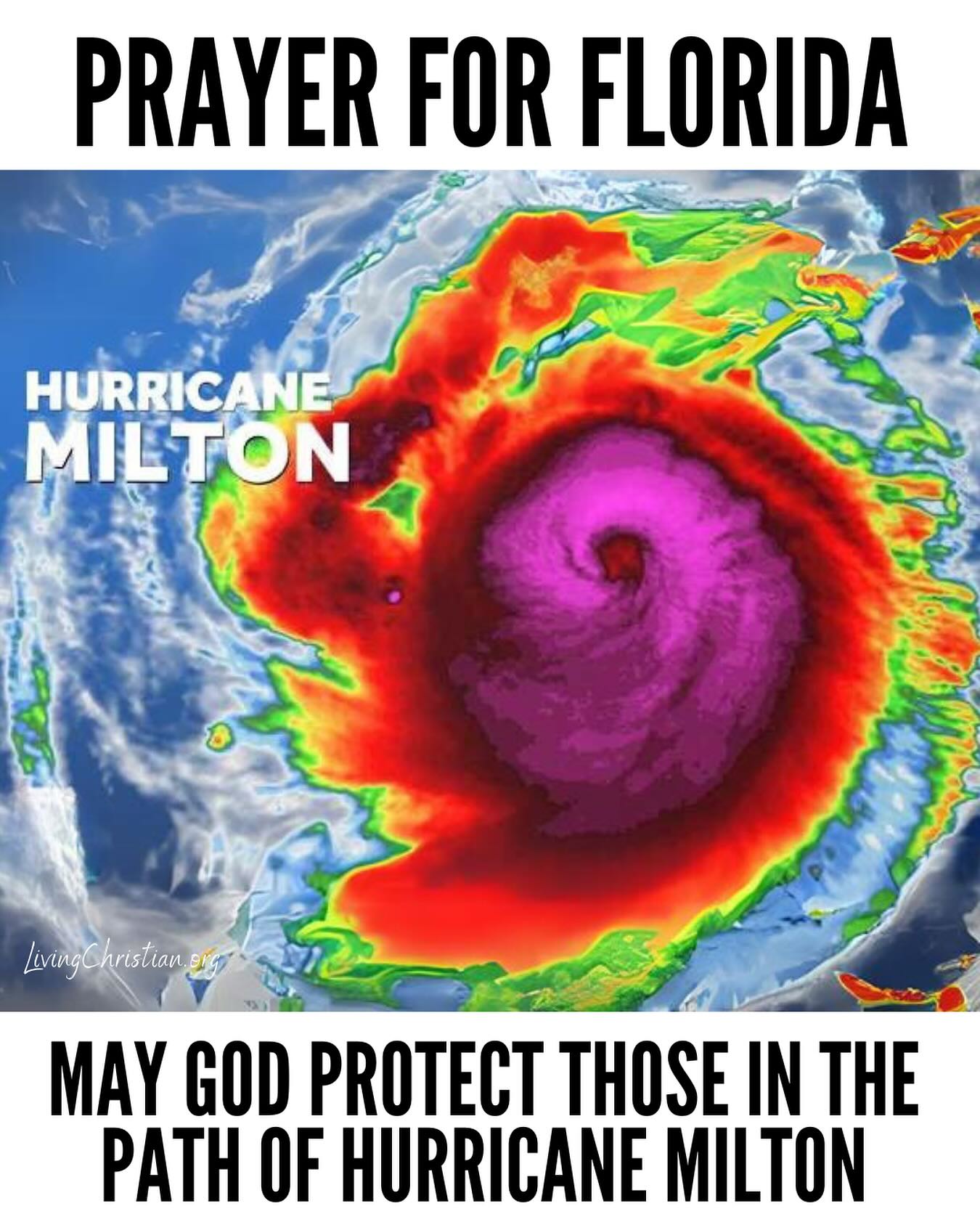
Hurricane Milton, currently churning in the Gulf of Mexico as a major storm, is expected to make landfall somewhere along Florida’s west coast soon.
Milton has fluctuated in intensity over the past few days, rapidly becoming a monster Cat. 5 storm in mere hours on Monday. After brief weakening for eyewall replacement, the National Hurricane Center said Milton regained its Category 5 status Tuesday — and traveled like that for hours.
At 8 a.m., the NHC said Milton had weakened to a Category 4 system with winds of 155 mph.
Latest Milton forecast below.

As the major system closes in on Florida with slightly less intensity, the NHC warns residents that conditions will begin to deteriorate Wednesday afternoon.
“Preparations, including evacuation if told to do so, should be rushed to completion this morning,” the NHC said.
While officials originally predicted landfall at Category 3 intensity, new models are hinting at a Category 4 landfall instead.
Models are still nailing down exactly where the storm will make landfall, but officials warn Tampa and surrounding areas to prepare for the impacts of a direct hit.
When will Hurricane Milton hit Florida?
While Milton has varied in speed and direction over the past few days, the latest advisory from the NHC forecasts Milton making landfall on the Gulf coast of Florida late Wednesday night.
The NHC says landfall could be early Thursday morning depending on the speed of the system as it approaches the state. By Thursday afternoon, Milton is expected to move off the east coast of Florida and head out to the Atlantic.
Where is Hurricane Milton right now?
According to the NHC’s 8 a.m. advisory, Milton is currently 250 miles southwest of Tampa and moving northeast at 16 mph.
The next NHC advisory is expected to come out at 11 a.m.
How strong is Hurricane Milton?
Milton is currently moving through the Gulf of Mexico with maximum sustained winds of 155 mph and a minimum central pressure of 915 mb, showing subtle signs of weakening from earlier advisories.
This is in line with most model data that predicted the storm would slightly weaken from wind sheer during its approach. However, “Milton is expected to be a dangerous major hurricane when it reaches the west-central coast of Florida,” the NHC said.
Milton watches, warnings
A storm surge warning is in effect for:
- West coast of Florida from Flamingo northward to the Suwannee River, including Charlotte Harbor and Tampa Bay
- Sebastian Inlet, Florida to Altamaha Sound, Georgia, including the St. Johns River
A hurricane warning is in effect for:
- Florida’s west coast from Bonita Beach northward to the mouth of the Suwannee River, including Tampa Bay
- Florida’s east coast from the St. Lucie/Martin County line northward to Ponte Vedra Beach
- Marion County
- Seminole County
- Orange County
- Lake County
- Osceola County
- Polk County
- Sumter County
- Flagler County
- Volusia County
- Brevard County
A storm surge watch is in effect for
- North of Altamaha Sound, Georgia to Edisto Beach, South Carolina
A hurricane watch is in effect for
- Dry Tortugas
- Lake Okeechobee
- Florida’s west coast from Chokoloskee to south of Bonita Beach
- Florida’s east coast north of Ponte Vedra Beach to the mouth of the St. Mary’s River
- Florida east coast from the St. Lucie/Martin County line to the Palm Beach/Martin County line
A tropical storm warning is in effect for:
- All of the Florida Keys, including Dry Tortugas and Florida Bay
- Lake Okeechobee
- Florida west coast from Flamingo to south of Bonita Beach
- Florida west coast from north of the mouth of the Suwanee River to Indian Pass
- Florida east coast south of the St. Lucie/Martin County line to Flamingo
- North of the Ponte Vedra Beach to the Savannah River
- Extreme northwestern Bahamas, including Grand Bahama Island, the Abacos and Bimini
A tropical storm watch is in effect for :
- North of the Savannah River to South Santee River, South Carolina
How will Milton impact Florida?
According to the NHC, the greatest impacts from Hurricane Milton are storm surge, rainfall and high winds.
Officials say storm surge from Milton will raise water levels and create “large and destructive waves.” Normally dry areas near the coast could be flooded by rising waters moving inland from the shoreline. The intensity of the surge will greatly depend on timing and the tidal cycle.
Rainfall is expected to add to the destruction, with some portions of Florida seeing up to 18 inches of rain. These conditions could lead to “catastrophic and life-threatening” flash, urban and areal flooding, the NHC says, adding that there is a risk for moderate to major river flooding.
How will Milton impact Orlando, Central Florida?
Under tropical advisories for multiple days now, residents in Orlando should prepare for intense impacts from Milton.
The biggest threats in many local counties include flash flooding, tornadoes and torrential downpours. Based on Milton’s current track, some portions of the Central Florida area could also see dangerous sustained winds and gusts topping 100 mph.
Hurricane Milton comes right on the heels of Hurricane Helene’s devastating landfall in the Florida Big Bend region as a Category 4 storm. Many Florida residents are still recovering from intense flooding, damaging storm surge and extreme wreckage from winds topping 140 mph.
First Warning Weather
Stay with WESH 2 online and on-air for the most accurate Central Florida weather forecast.